PAC Playbook: Data + game for mobility hubs
A practical guide for cities to co create inclusive mobility hubs with communities
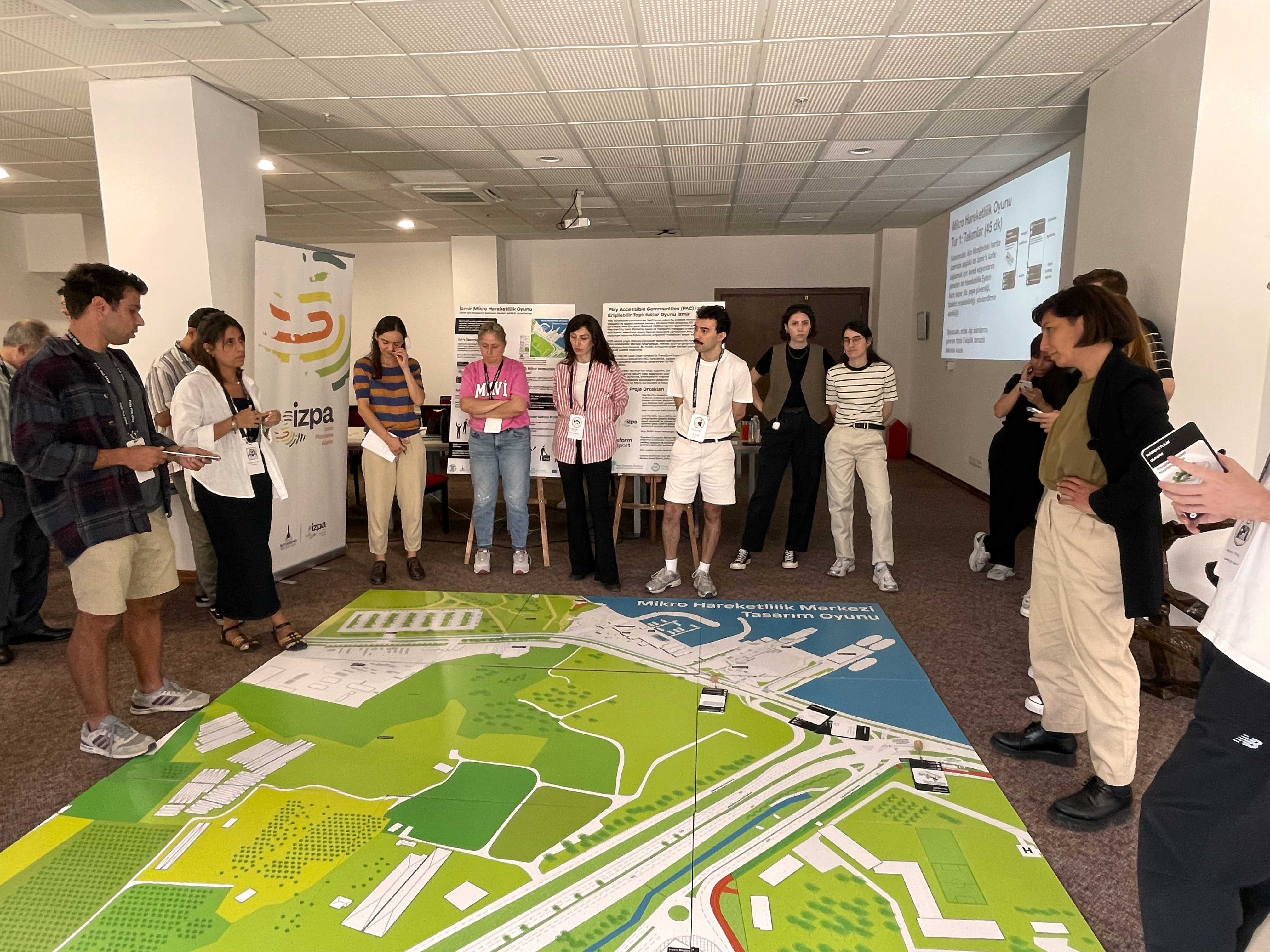
Credit: Play the City - Shared plan for Üçkuyular as a result of the participatory Mobility design game
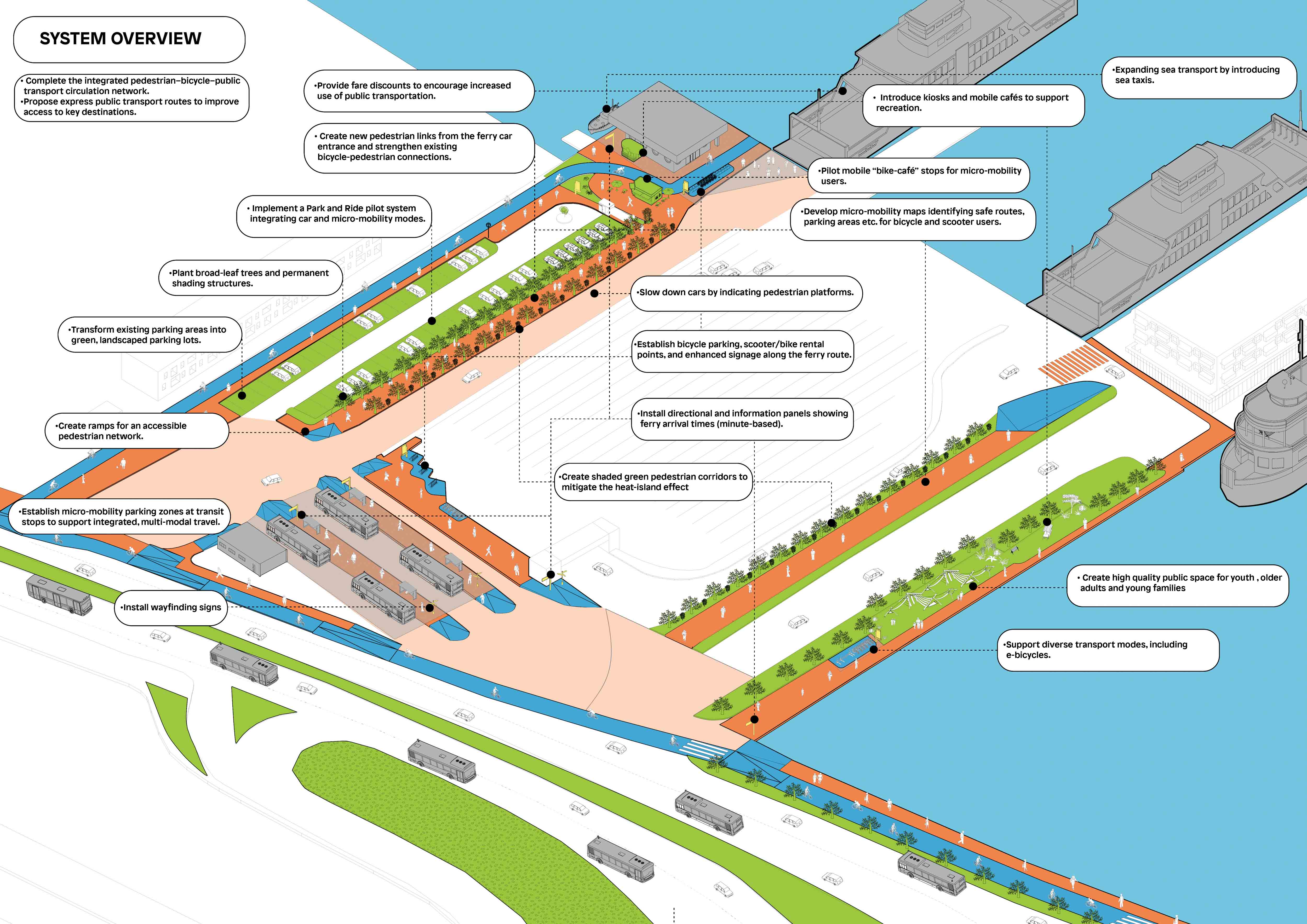
Credit: Play the City - Shared plan for Üçkuyular as a result of the participatory Mobility design game
Resource
Context
How İzmir is reimagining its mobility hubs with and for its citizens
İzmir stretches along the Aegean coast. It is Turkey’s third‑largest city, and like many Mediterranean cities, it has mostly grown around cars. Public spaces are often fragmented. Streets belong more to traffic than to people.
Take Üçkuyular. A tram station, a ferry pier and a bus terminal meet there, next to a forest. Thousands of people pass through every day, changing from one mode to another. But no one stays. It is a transport hub, not a proper place.
Across Europe, similar interchanges are designed by engineers for efficiency. Young people, migrants, elderly residents and women are rarely consulted. The result is then functional, but rather cold.
The Play Accessible Communities project (PAC) was selected under the EIT Urban Mobility Co‑Create New European Bauhaus 2025 programme. It brought together four partners: Play the City, Transform Transport, the İzmir Planning Agency, and the İzmir Metropolitan Municipality.
The challenge was simple: turn Üçkuyular into a place where people actually want to spend time, and not only a place where they have to.
The resource in a nutshell
A replicable way to turn mobility data into public spaces people actually want to use
PAC is not a software or a product you buy. It is a method that any city can follow, built around three things: looking at the right data, running hands‑on games with local people, and writing down what works so others can do the same. The main outputs are the PAC Micro Mobility Playbook, the Micro Mobility Game design, and templates for facilitators.
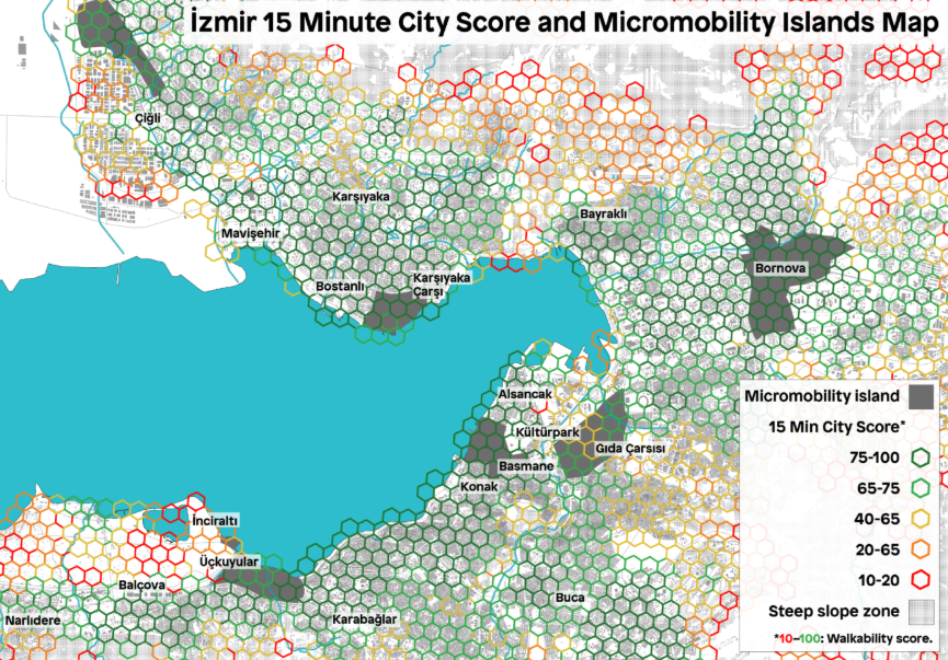
Here is how PAC was put in place. First, Transform Transport applied their existing open‑source toolkit, the 15‑Minute City Score Toolkit, which uses OpenStreetMap data to measure how easy it is to walk to schools, shops, doctors, and other daily destinations. The results become simple and colourful maps that show where a neighbourhood is doing well and where it is “failing”. The good point is that anyone with basic computer skills can run the analysis.
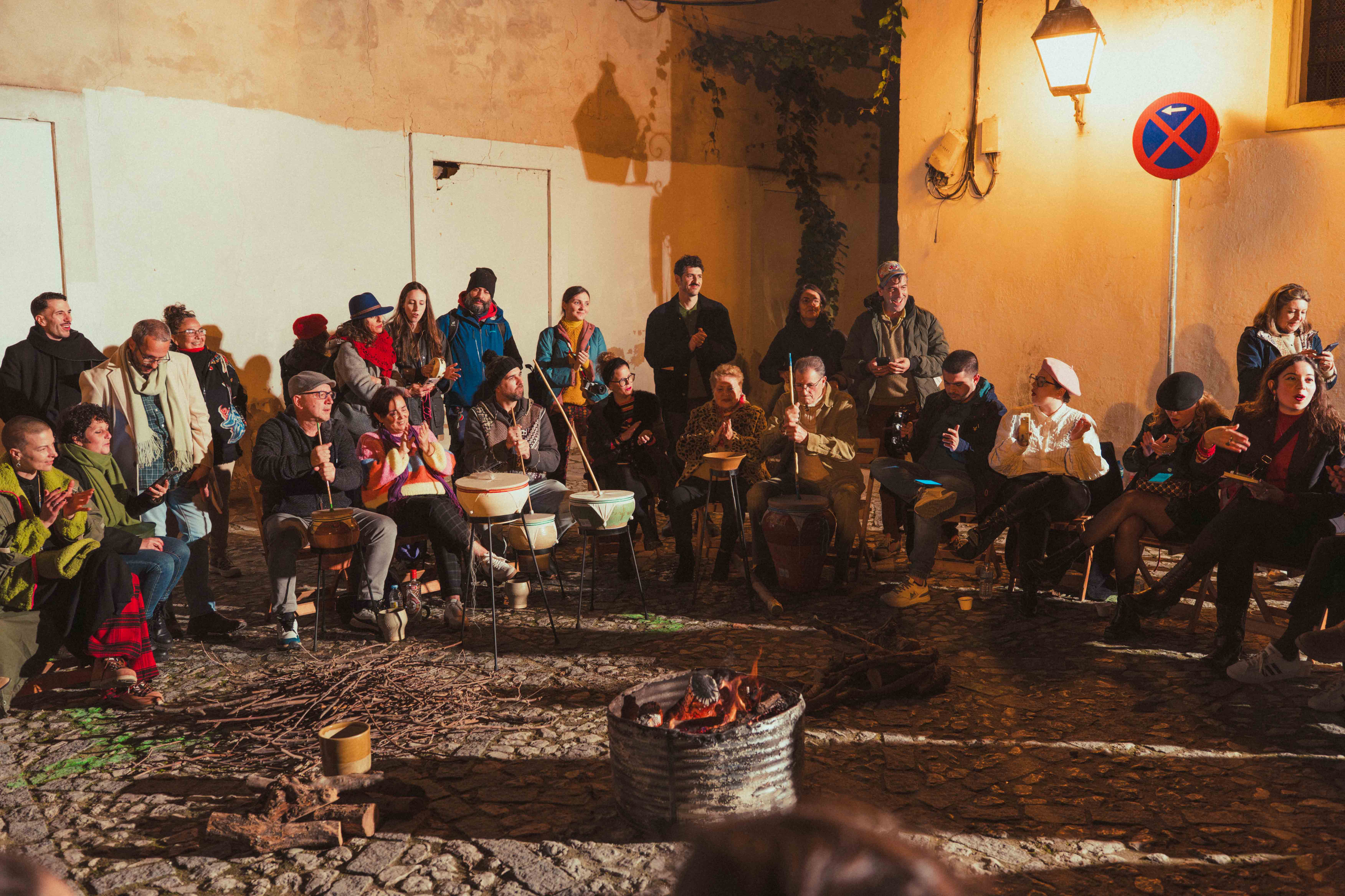
Those maps then are the starting point for a game. Play the City designed a tabletop exercise that takes about two hours. Participants get role cards, a budget, and a board that looks like the real site. Residents sit next to municipal officers and mobility experts. Together they negotiate, make compromises, and vote on what should change. The game works well because it gives everyone a voice, not just the loudest people in the room.
What can you do with this method? You can redesign a bus interchange, a train station forecourt, a square next to a tram stop. The process delivers a short list of actions that people actually agreed on, sketches of what those changes could look like, and a roadmap that fits with existing city plans.
To run it, you need someone comfortable with maps and data, and someone who can facilitate a group without taking over. The playbook explains the rest: how to find the right participants, how to work with sensitive groups like migrants or older residents, and how to write up the results so they are useful. On top of that, the toolkit is open‑source and free.
This project has been supported by the EIT Community NEB programme in 2025.